– Salinas schools, children, and homes getting high, repeated exposure to methomyl, banned in over 50 countries for toxicity

Comments by Karen Cameron, concerned Salinas citizen, on August 11 to the Monterey County Board of Supervisors.


Salad bowl of the world, yet we’ve had no air monitor from CDPR [California Department of Pesticide Regulation] since 2017, so we don’t know what we’re breathing in terms of pesticides. It was interesting to read through the environmental justice element of the Monterey County General Plan, where CalEnviroScreen data was shared from Office of Environmental Health Hazard Assessment on pesticides accumulation in some of the disadvantaged areas. 99% accumulation in Boronda, Las Lomas, Moss Landing, Castroville. The list goes on. In Pajaro, where we have our closest air monitoring, it’s listed at 79 to 100% accumulation. That’s very concerning to me. We seem to live in a time when we’ve normalized this behavior. I flash back to 1962 where Rachel Carson published Silent Spring with many of these same concerns. My colleagues from Safe Ag Safe Schools and Future Leaders of Change are right now in Sacramento marking 30 years for California for pesticide reform. Just wanted to share with you that on a local level, I have a big concern I shared with the city council this week in Salinas. I met with the Monterey County Ag Commissioner by phone for over 20 minutes, displaying a concern that I have from spray days notification data that I have collected for two schools in Salinas that are near fields. University Park Elementary, I’ve noted 57 methomyl applications since May 10th. McKinnon Elementary, over 50. And to tell you the truth, I think I’ve missed a couple because it’s so hard to keep up with this. That is a minimal number I could document. Now the Ag Commissioner in our conversation not only confirmed that methomyl, these applications are all methomyl, is banned in over 50 countries for its toxicity, yet he is signing off on every application. And he admitted to me that this trend is going on for the next month at least. We share concerns that school is in session. I share concerns that I’ve had seasonal health concerns that seem to calendar in concern with this. So I’m asking all of you to speak out to the Ag Commissioner and please research methomyl. Thank you.

Video

Ms. Cameron advocates for transitioning to organics and a one mile buffer zone around schools. She is a member of Safe Ag Safe Schools and Californians for Pesticide Reform.

Additional comments to Salinas City Council, August 18, 2026
https://fb.watch/J7iXsqNRr_/?mibextid=wwXIfr
(In her remarks, Ms. Cameron meant to say a one mile buffer zone is necessary)
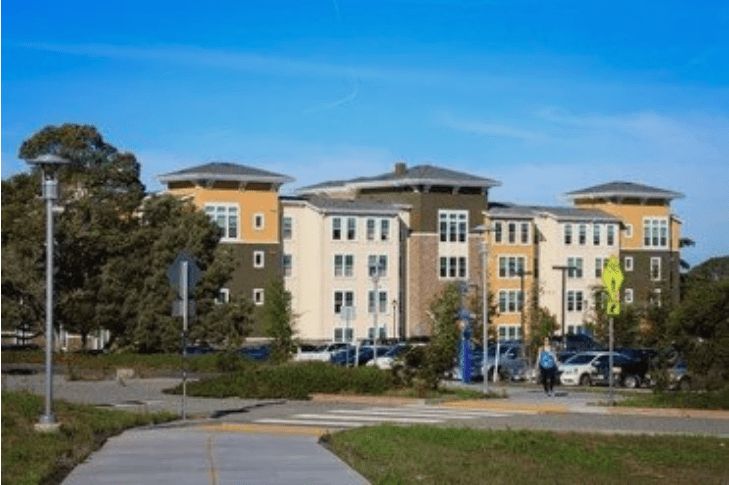
– Eight former CSUMB students or spouses report cancer diagnoses near Fort Ord’s toxic industrial zone

From Military Poisons
August 11, 2026
by Pat Elder

New cancer cases at Promontory Housing spark investigation into nearby military contamination.

Blood Cancer Cases

  • An individual referred to as Caleb diagnosed with lymphoma.
  • An additional student with a lymphoma diagnosis.
  • A former student who passed away from multiple myeloma at age 57
  • A student who was diagnosed with leukemia while residing in the area.
  • A second report of leukemia involving the son of a community member

Breast Cancer Cases

  • A local resident and former student who passed away from breast cancer at age 37.
  • A student diagnosed with breast cancer.

Ovarian Cancer

  • A former student diagnosed with ovarian cancer alongside multiple medical complications.
    See Julie Akey’s database of more than 2,000 people who suffer with disease or are deceased and lived on the former Fort Ord or on lands there were later developed.

The Promontory Apartment student housing complex at the California State University, Monterey Bay was built adjacent to severely contaminated land.

Within roughly a third of a mile of today’s apartments stood a dangerous concentration of Army facilities that handled herbicides, chlorinated solvents, medical waste, petroleum products, pesticides, and electrical equipment.

Two students who lived at Promontory have been diagnosed with lymphoma, leading us to search for potential causes nearby.

In August 2015, California State University, Monterey Bay opened the Promontory Apartments. The complex consists of three four-story apartment buildings containing approximately 174 apartment units and 579 student beds, later expanded to approximately 789 beds.  It was the university’s first new student housing project in more than a decade and today houses hundreds of upper-division students immediately adjacent to the former industrial core of Fort Ord.

They put it in a horrible location. Students and their parents are unaware that they are just footsteps from the potentially dangerous toxic epicenter of former Fort Ord.

Fort Ord was no ordinary military base. Between World War I and its closure in 1994, an estimated 1.5 million American soldiers passed through its gates for basic training, combat preparation, and overseas deployment. At its peak during the Vietnam era, the installation encompassed nearly 28,000 acres and housed as many as 50,000 troops, functioning as one of the Army’s largest and most sophisticated training centers. Thousands of buildings, miles of roads, maintenance depots, hospitals, warehouses, motor pools, firing ranges, fuel storage areas, and utility systems operated around the clock to support the enormous logistical demands of preparing soldiers for war.

This vast military enterprise was built during a period when industrial chemicals were promoted as exciting technological breakthroughs. Chlorinated solvents, petroleum products, pesticides, herbicides, heavy metals, and PCBs were indispensable tools of modern military operations.

Throughout the period, military planners and chemical manufacturers possessed clear scientific understanding of the environmental and health hazards, yet consciously prioritized tactical utility and cost over public safety, actively hiding or ignoring the data for decades.

Let’s study the Fort Ord “cleanup” map and today’s Google Map.

The historic Fort Ord cleanup map is aligned with the modern Google satellite image here.  The Google map is not drawn to scale.

The wind blows off the ocean, predominately from the north and west. (from the top left) That’s bad news because the Red X represents the former incinerator at Building 1442, and the Blue X, 1,800 feet southeast, represents the location of Promontory student housing.

The Black X is the site of today’s athletic field, while the Green X, in the center of things, is the site of the notorious Pete’s Pond. The Brown X is Building 4900, the epicenter of volatile organic compound (VOC) contamination on base.

Approximate distance in feet from Promontory Apartments to toxic sites:

Pesticide Building 4891  600
Pete’s Pond                    750
Building 4900                1200
Athletic Field (center)     1250
Incinerator                      1800

The Building 1442 Incinerator and  Dioxins and Furans

Rather than shipping highly toxic medical waste from the nearby hospital off-site, the Army constructed Building 1442, an industrial incinerator that operated for nearly forty years.

The old Fort Ord Hospital was located about two blocks from the Building 1442 incinerator. During the period from the 1930s to the 1960’s, military hospitals relied heavily on crude chemical preparations for infection control and diagnostics. This generated waste stream materials that would today be managed as highly regulated hazardous waste.

These early medical mixtures contained a complex array of toxins, including mercury from various uses, mercuric antiseptics like Merthiolate, lead shielding, X-ray film wastes, and silver-bearing photographic processing chemicals. The waste stream was further complicated by formaldehyde, phenolic disinfectants (such as carbolic acid and cresols), ether, laboratory solvents, pharmaceutical wastes, and infectious biological materials.

The incinerator at Building 1442 burned it and sent plumes of smoke in the direction of today’s Promontory Housing. The low burning temperatures synthetically generated highly carcinogenic dioxins and furans. The brick incinerator was located 150 feet northwest of today’s athletic field and 1,800 feet from the Promontory Apartments. It created 2,3,7,8-tetrachlorodibenzo-p-dioxin (2,3,7,8-TCDD). We call it dioxin.

A molecule of 2,3,7,8-TCDD created in the small brick incinerator reacts inside the human body exactly like a molecule of 2,3,7,8-TCDD found in the Agent Orange defoliant sprayed over 9,000 acres of Fort Ord and mixed in Buildings 4891 and 4897 just a few hundred feet from the Promontory Apartments. 

Dioxin is one of the most toxic environmental pollutants in the world. Once inside the human body, dioxin sneaks into cells and hijacks the master controls that tell them how to grow. At the same time, it deals a crushing blow to our immune system. It causes the thymus—the special organ where our body’s ‘soldier’ cells (T-cells) are trained—to shrink and weaken. Without healthy T-cells to defend us, and with normal cell growth thrown into chaos, the body loses its ability to fight off threats. This dangerous combination of broken cell controls and a crippled immune system greatly increase the risk of aggressive blood and bone marrow cancers.

The resulting hazardous ash and unburned medical refuse were routinely disposed of in unlined burial pits and trenches across the Site 17 yard, creating a heavily contaminated ash footprint directly over today’s athletic field.

From these unlined trenches, seasonal winter rains systematically washed the toxic residues downhill into Pete’s Pond. Concurrently, heavy equipment maintenance at the adjacent Building 4900 was draining volatile organic compounds (VOCs) straight into the local soil. Because Pete’s Pond, a 3.3-acre triangular depression and its adjacent extension formed the natural, low-lying stormwater catchment basins for the local topography, decades of rain and surface runoff washed these smaller medical fragments, toxic ash, and contaminated soils downhill. This process concentrated a dense sediment mix of metals, dioxins, furans, Total Petroleum Hydrocarbons (TPH), VOCs, and medical waste inside the pond basin, while deeply contaminating the local groundwater table with tetrachloroethylene (PCE), trichloroethylene (TCE), and carbon tetrachloride (CT).

The Army excavated approximately 107,000 cubic yards from Site 17 and 27,770 cubic yards of impacted soil from Site 16. The debris identified at the Site 17 Disposal Area extended to depths of 20 feet below ground surface.

Many Olympic-sized swimming pools measure 50 meters long, 25 meters wide, and 3 meters deep, potentially holding approximately 4,905 cubic yards of soil.

Altogether, the Army removed the equivalent of 134,770 yards of highly contaminated soil from the Site 17 site alone,  and moved it a little more than a mile away to the massive OU-2 landfill. This is about the same as 27 Olympic-sized pools.

Statistically, if the 107,000 cubic yards of soil had been removed perfectly uniformly across the 11.2-acre parcel, it would equate to a clean removal of 5.92 feet of topsoil from the surface.

In practice, industrial environmental cleanups rarely mimic a uniform grading project; instead, deep columns of contamination require carving out narrow, vertical trenches down to critical hot-spot depths, while large swaths of adjacent land receive only a superficial scrape. It is highly likely that dioxins and furans were left at or near the surface across large swaths of the remaining land between the incinerator and the ground extending to the Promontory Apartments.

A vertical slice of the 11-acre parcel prior to remediation (encompassing the athletic field today) would likely reveal a starkly layered column of industrial toxins:

  • 0 to 5 Feet (Surface Layer): Dominated by the hospital’s highly immobile, strongly adsorbing residues—specifically carcinogenic dioxins, furans, and heavy metals.
  • Shallow Subsurface (Tens of Feet): Characterized by Total Petroleum Hydrocarbons (TPHs). Due to their chemical properties, these hydrocarbons were primarily retained within the upper tens of feet of the subsurface where they adsorbed to organic soil fractions and degraded.
  • Deep Subsurface (Below Excavation Limits): Highly mobile chlorinated solvents—such as PCE, TCE, and carbon tetrachloride—readily bypassed the shallow soils, migrating through the sandy matrix many times deeper than the maximum depths of physical excavation, continually feeding the underlying groundwater plumes.

While the heavy earthmoving machinery and deep 20-foot excavation pits cleared out hot spots at today’s athletic field and the core of Sites 16 and 17, the physical boundaries of that digging stopped abruptly at the eastern edge of Site 16, roughly aligned with the present-day 5th Street corridor.

This left a narrow, protective buffer of perhaps 500-600 feet of terrain between the easternmost edge of the excavation zone and the westernmost walls of today’s Promontory Apartments. This geographic buffer was also littered with deadly industrial toxins and offers no protection against long-term carcinogenic dusting and deep subsurface liquid plume migration.

Because the wind blows predominantly from the ocean to the east, the Promontory housing campus sits directly downwind of the primary emission sources.

Buildings 4891 and T-4897 – Pesticide Storage and Mixture

Students at the Promontory Apartments and their parents are unaware they are sleeping mere footsteps from the toxic epicenter of the former Fort Ord. Historical records and expert analysis reveal that Building 4891 (located just 500 feet west of student dorm rooms) and Building T-4897 (located 900 feet southwest) served as the military installation’s primary hubs for storing, handling, and mixing tactical herbicides.

It was within these two structures that Army personnel routinely formulated chemical compounds, including 2,4-D and 2,4,5-T, the active ingredients used to create Agent Orange for base-wide weed control programs.

A December 1980 Department of the Army letter, which the Board of Veterans’ Appeals later designated as “highly probative” in granting a veteran service connection for toxic exposure, conclusively states that the Pest Control Shop at Fort Ord maintained detailed monthly records dating back to January 1973 proving that both 2,4,5-T and 2,4-D were actively used on the installation (see BVA Citation Nr: 19185283).

The regular use of Agent Orange dates back to 1951.‍ ‍

Although the Army maintains that Agent Orange was never used at Fort Ord, the public record  tells a different story.  Many veterans have pursued appeals before the Board of Veterans’ Appeals, alleging exposure to Agent Orange or other tactical herbicides at Fort Ord. The Pentagon and the VA have denied the clearly documented use of Agent Orange at hundreds of locations in the U.S. and worldwide. Building student housing in this location demonstrates a callous disregard for student health.

Building 4891 was built with a crude, unbermed concrete floor, meaning there were no retaining lips or barriers to catch chemical overflows. Like Building 4897 it contained an internal utility sink positioned directly next to an open French drain that dumped chemical rinse-water straight into the unlined soil beneath the building.‍‍

An artist’s rendition of a French drain.

Because of this design, decades of routine handling of highly persistent organochlorine pesticides—specifically: 2,4-D, 2,4,5 -T, Chlordane, DDT, Dieldrin, Lindane, Sevin, Baygon, Diazinon, Warfarin, and Malathion leached directly into the subsurface sands.

This is the view from 5th Ave., looking east over the site of former Building 4891 with the Promontory Apartments in the background.

The highest chlordane concentrations ever reported at Fort Ord, rivaling anywhere on earth, up to 4,000,000 µg/kg in near-surface soils, was reported adjacent to Building T-4897.  It is likely still present in soils. Chlordane was one of the more hazardous pesticides handled at Fort Ord. A persistent organochlorine insecticide, it attacks the central nervous system and can damage the liver.

Fort Ord Pest Control Shop Pesticides

Building 4900

Building 4900 served as the Main Maintenance Center Building for heavy equipment. It generated massive hazardous waste streams. The building was a bustling, multi-wing industrial hub dedicated to repairing tactical hardware, weapons systems, and heavy military transport vehicles. The small arms shop operated a chemical dipping line and housed a spray-painting bay used for refinishing military equipment and heavy vehicles.

The Steam Cleaning Station was a wash rack and a diesel-powered steam cleaning unit that used Trichloroethylene (TCE) and Tetrachloroethylene (PCE), to wash vehicle undercarriages before they entered the main repair bays. These chemicals were allowed to sink into the soil.

Diesel fuel, gasoline, used motor oil, and spent antifreeze were also allowed to drain into the ground or routed to Pete’s Pond.  Building 4900 generated rivers of used oil and spent antifreeze annually. Additionally, a 1,500-gallon underground diesel storage tank (UST) sat right next to the building along with an above-ground tank, creating petroleum-saturated soil zones that had to be excavated during base “remediation.”

This all took place about two city blocks from today’s Promontory student housing, while the subterranean toxic liquids headed toward today’s student complex.

The paint shop’s overspray and the battery maintenance activities deposited heavy metal residues into the surrounding ground. Lead, chromium, cadmium, and high concentrations of phosphates were discarded.

Drainage from Building 4900 was designed to catch runoff. The drains emptied directly into Pete’s Pond. As a result, industrial spills, oil residues, and paint solvents washed off the Building 4900 aprons during rainstorms and settled directly into the local surface soils.

Pete’s Pond

Pete’s Pond was essentially an open-air collection basin for the waste of a sprawling military-industrial complex. Its crude design—little more than a depression intended to receive stormwater and drainage—meant that runoff could carry petroleum products, solvents, pesticides, metals, incinerator residues, and other contaminants from surrounding maintenance and disposal areas into the same low-lying location. Rather than protecting the environment from contamination, Pete’s Pond concentrated decades of Fort Ord’s industrial activity in one place, allowing contaminants to accumulate in its soils and sediments and, potentially, migrate downward through the exceptionally permeable sandy soils beneath the base. Pete’s Pond and its extension, a former Fort Ord drainage and disposal area, were located roughly one-third of a mile from the site of today’s Promontory student housing.

Building 4890 PCB Storage and Testing Area

PCBs can last for centuries in the environment depending on where they land and their specific chemical makeup.

Electrical transformers were transported to Building 4890, located about 1,200 feet southwest of the Promontory Apartments. It served as the centralized processing checkpoint for electrical transformers harvested from all sectors of the military installation.

PCBs were widely used in electrical transformers because they made exceptionally effective dielectric fluids, serving both as electrical insulators and as coolants that carried heat away from energized components.  Transformers were placed in containment spill pans while personnel extracted and tested the internal dielectric fluids. The facility operated an open-air tin shed constructed on a thick concrete foundation slab. According to the Army, decades of continuous industrial processing left no chemical footprint across the immediate site. 

Walking through the area poses no acute danger, but touching the sandy soils and transferring contamination to fingers and ingesting could become a problem.

Much of the investigation that cleared the site was conducted in the early 1990s. Analytical methods, detection limits, and our understanding of how PCBs persist and migrate through the environment have improved substantially since then.

Much of the investigation and remediation described in the Army’s records occurred more than thirty years ago. Since then, analytical detection limits have fallen dramatically, sampling techniques have improved, and scientific understanding of vapor intrusion, contaminated dust, persistent organic pollutants and subsurface contaminant migration has advanced.

‍The history documented here provides ample reason for a new, independent environmental assessment of the area surrounding Promontory. ATSDR’s recent reevaluation of its earlier Fort Ord work does not eliminate that need. The agency’s review was deliberately narrow, revisiting the drinking-water exposure questions examined in its 1990s assessment and limiting its evaluation to the 1985–1994 period. It did not constitute a comprehensive modern investigation of the environmental conditions surrounding today’s campus or other residential areas, nor did it evaluate the full range of potential exposure pathways presented by the former industrial sites. That assessment should include targeted surface and subsurface soil and sampling for pesticides, PFAS, PCBs, dioxins VOC’s, and metals, together with appropriate evaluation of groundwater, soil gas and indoor-air pathways for volatile contaminants.

Considering everything that took place within a few hundred yards of these apartments, students, parents and university employees should not have to rely solely on environmental conclusions reached when this was still an Army base.

Julie Akey in 1996 at Fort Ord.

Julie Akey was active-duty Army and lived at Fort Ord in 1996 and 1997 while attending the Defense Language Institute in Monterey and studying Arabic. Roughly two decades later she developed multiple myeloma, a malignant, generally incurable blood cancer. She discovered she was not alone. Julie began looking into Fort Ord’s environmental history and created the Facebook group,  Cancer and Illnesses from Fort Ord, CA military base.‍ She was able to identify 138 people who lived at Fort Ord and were diagnosed with Multiple Myeloma.

‍Former Fort Ord residents with similar illnesses began finding Julie. She has collected a database of more than 2,000 people who got very sick and lived and worked on the base, including the Promontory Housing area.

‍Julie has documented cancer cases of students at Promontory and throughout the lands occupied by the former Fort Ord.

Julie, and those with the Fort Ord contamination group are deeply concerned about the health of university students who live and study at the epicenter of several heavily contaminated zones within the former Fort Ord.

She explained. “We are bringing this to people’s attention because we are concerned for the students, and those who have already reported to us that they are sick. We are trying to do the right thing, drawing attention to this injustice while the press and government agencies have failed us.  This will likely be the last time we’ll ask for a dollar. We’ll be on campus and other areas of the old base, testing water, soil, and air this fall.  It’s expensive. Could you please help us?”

‍Please, go here, to the bottom of the page, to contribute: 
https://www.fortordcontamination.org/‍ ‍‍‍‍‍‍‍‍‍‍‍‍‍‍‍‍‍ ‍

Sources:

Main Garrison Fort Ord Map, 2003

Draft Final – Field Investigation and Data Review – Solid Waste Management Units – Fort Ord, CA, July, 2002

Draft Final Five-Year Review Report First Five-Year Review  Report For Fort Ord Superfund Site Monterey, California August, 2002‍‍ ‍

https://www.militarypoisons.org/latest-news/eight-former-csumb-students-or-spouses-report-cancer-diagnoses-near-fort-ords-toxic-industrial-zone

– Monterey County: General Plan Environmental Justice update, comments due July 31

From County of Monterey:

The public review period for the Draft Environmental Justice Element has been extended through Friday, July 31, 2026.

The Environmental Justice Element is required by state law as included in the County of Monterey General Plan to identify disadvantaged communities within the unincorporated County area. Environmental justice goals, policies, and objectives to reduce unique or compounded health risks are required to include reduction of pollution exposure, improvement of air quality, the promotion of public facilities, food access, safe and sanitary homes, physical activity, civil engagement in the public decision making process, and prioritize improvements and programs that address the needs of disadvantaged communities.

Draft Environmental Justice Element:
https://montereyclimateaction.konveio.com/county-monterey-draft-environmental-justice-element

[The county has also prepared community guides based on some feedback from specific areas]

Community guides are available in English and Spanish.

  • Please submit your comments to the department at the following address:
    County of Monterey Housing and Community Development Department
    Attn: Edgar Sanchez, Project Planner (English/Español)
    1441 Schilling Place, South 2nd Floor Salinas, California 93901
  • Or Via Email to: GeneralPlanUpdates@countyofmonterey.gov
  • For questions, please contact Edgar Sanchez by phone at (831)783-7508 (English/Español)

Use the above email address to be added to the distribution list. In the subject line, write: Environmental Justice Element

https://www.countyofmonterey.gov/government/departments-a-h/housing-community-development/planning-services/advance-planning/ordinances-plans-under-development/general-plan-elements-update-environmental-justice-element-ref220017-lrpwp-task-no-21-10

– June 5: EPA deadline to comment on Google plan to release 64 million bacteria-infected mosquitoes in California and Florida

Comment deadline: Friday, June 5
EPA Docket No. EPA-HQ-OPP-2025-3951

Experimental use permit for Google to release 64 million bacteria-infected mosquitoes in California and Florida

The EPA opened public comments May 6 but provided no public notice in Monterey County newspapers, despite the potentially serious health and environmental impacts.

The public comment must be extended for minimum30-45 days, after notice has first been posted in area newspapers by the EPA, paid for by Google.

This experiment could:

— Create more resistant, stronger mosquitoes
— Disrupt a vital food source for bats, birds, and fish which could cause devastating effects
— Cause illness and death to wildlife which consumed these mosquitoes
— Cause severe disruption and harm to the entire ecosystem
— Cause damage to agriculture
— Cause illness or death in humans bit by these mosquitoes

The docket even fails to state the locations where these engineered insects will be released.

The state of California and the US government has conducted many experiments on nature and humans, claiming that these would have no damaging effect. Sometimes these experiments have been secret and only discovered years later.

The EPA has come under intense criticism for its suppression of information and acting against the public interest in East Palestine, the Fukushima disaster, and most recently, at the Moss Landing Battery Storage fires, where they used inappropriate sampling methods which diluted toxins, with the results that they found no significant exposure [see Moss Landing Monterey County Board of Supervisors hearing 3/17/26 under the Energy/Utilities tab]

https://downloads.regulations.gov/EPA-HQ-OPP-2020-0028-0010/content.pdf
EPA Registration Decision for the New Active Ingredient
Wolbachia pipientis wAlbB strain in male Aedes aegypti mosquitoes

In this docket, the EPA only allowed a 30 day comment period.

Background information on this initiative:
https://www.globalresearch.ca/google-64-million-mosquitoes-florida-california/5928523
Google to Release 64 Million Bacteria-Infected Mosquitoes into Florida and California, by Nicolas Hulscher

https://www.regulations.gov/document/EPA-HQ-OPP-2025-3951-0001
Google LLC Experiment Docket Page

https://downloads.regulations.gov/EPA-HQ-OPP-2025-3951-0001/content.pdf
Federal Register Notice

– Monterey County fails to protect the public from cancer-causing pesticides and banned fumigants – recent expert comments

More than a fifth of organophosphate use by pounds in California is concentrated in Monterey County

On May 12, 2026, members of the public and the coalition Safe Ag Safe Schools provided detailed information to the Monterey County Board of Supervisors about very high toxic pesticide use by the ag industry in Monterey County, school and neighborhood exposures, contamination of farmworkers, children, and the communities including Salinas, the cancer risk, and inaction by county Agriculture Commissioner Juan Hidalgo. This follows Safe Ag Safe Schools’s April 30 letter to Hidalgo about the organophosphate and fumigant threats (excerpts below).

Video of the hearing:
https://monterey.granicus.com/player/clip/6128?view_id=21&redirect=true
Public comments begin at 1:00:35, comments on pesticides begin at 1:07:22 (transcript of comments by Beverly Bean is below)

Continue reading “– Monterey County fails to protect the public from cancer-causing pesticides and banned fumigants – recent expert comments”